
TeleResources can provide data sets for any area of the globe ranging from 5m to 90m order of accuracy. By ordering this data through us we are able to ensure that it can be used by our software.
Geodata types:
Digital Terrain Model (DTM)
A continuous model of ground-level land surface, represented by a digital raster grid with each grid cell holding an elevation value.
A DTM is a fundamental data input for radio propagation studies in that terrain blocks and reflects radio waves.
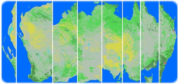
Clutter
Clutter refers to a Land Use/Land Cover classification of surface features which impact on radio wave propagation. These features are classed according to their physical and electrical properties.
Average obstacle height, local absorption power loss, co-efficients of correction and distance to clearing are some of the clutter-specific parameters that can be set and adjusted in propagation modeling. Image classification for RF propagation studies must accurately model clutter in terms of its influence on radio wave propagation.
CUSTOMER STORY
TELSTRA
TeleResources supplies Geodata solutions to all network owners and operators in the South Pacific Region, including Australia’s largest mobile network operator, Telstra.
